AARNet, Geoscience Australia, the University of Tasmania, and AuScope are collaborating to enhance positioning, navigation, and timing (PNT) services in Australia, with AARNet network connectivity playing a crucial role.
Geodetic data, including information on Earth’s spin rate and axis tilt, collected from observatories worldwide, is essential for numerous modern applications. These applications span ~3 billion smartphone apps, precision agriculture, weather forecasting, disaster modelling, financial transaction synchronisation, and power grid operations.
Various methods are employed by geodesists to study the Earth, but Very Long Baseline Interferometry (VLBI) is unique in observing and measuring Earth’s position, tilt, and spin rate. It is also the sole technique that measures the discrepancy between satellite atomic clock time and mean solar time, which is critical for providing synchronised time.
Recognising the significance of VLBI data, Geoscience Australia, AuScope, and the University of Tasmania operate three separate VLBI stations at geodetic observatories in Yarragadee (Western Australia), Katherine (Northern Territory), and Hobart (Tasmania). These observatories are part of a global network. Additionally, the Australian VLBI Correlation Centre, managed by Geoscience Australia and the University of Tasmania, collaborates internationally to process VLBI data for Global Navigation Satellite System operators.
Currently, the VLBI data, which ranges from 10 to 100 terabytes per observation session, must be physically transported to data centres in the US or Germany, causing a delay of at least 14 days before processing. This inefficiency hampers timely monitoring of Earth’s changes, affecting the accuracy and resilience of PNT services.
To tackle these challenges, the partnership with AARNet, Australia’s national research and education network, involves deploying new optical fibre connections and services to the Katherine and Yarragadee Geodetic Observatories. The Hobart Geodetic Observatory already has AARNet optical fibre connectivity and services through the University of Tasmania.
This upgrade will enable near real-time data processing, eliminating the need for physical transportation and significantly speeding up the availability of precise positioning information. This advancement is set to improve the accuracy and reliability of PNT services across various applications, including smartphone apps, precision agriculture, weather predictions, disaster modelling, financial transactions, power grid operations, and Global Navigation Satellite Systems (GNSS). These advancements will lead to increased accuracy, reliability, and efficiency across these fields, significantly enhancing their performance and outcomes.
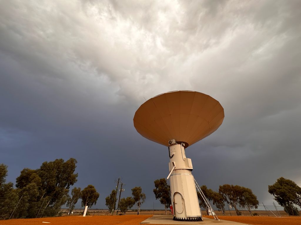
IMAGE CREDIT:
The 12m Patriot Antenna used for Very Long Baseline Interferometry observations at the Yarragadee Geodetic Observatory. Photo: Robert Nugent, Geoscience Australia Artist in Residence 2023.